Henges from the Air
The henges in north Northumberland are not easy to spot. There is virtually nothing to see on the ground. We have to wait for the right conditions. The differential growth that occurs between crops or grasses growing on quick-draining sand and gravel and those on the moisture-retaining soil that fills buried features is a boon for archaeologists. Those over the rich reservoir of moisture retain their colour and continue growing, whereas those over quick-draining sub-soils are parched and stunted. When conditions are at an optimum, such as during long, hot, dry summers, these differences are often visible from the air as patterns that reveal the locations and forms of the henges.
Examples

Wooler
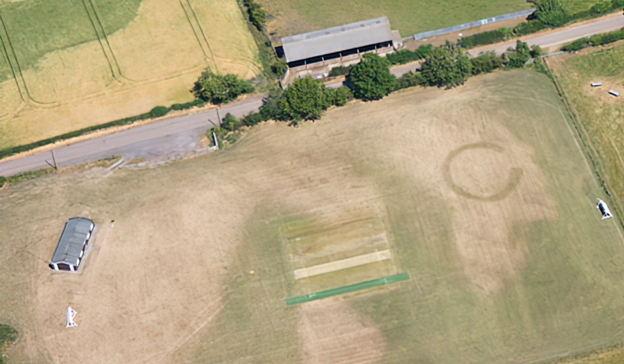
The shape and size of a henge, with its single eastern entrance, can clearly be seen here.
You are looking down on Wooler Cricket Ground and the wicket and pavilion will give you a sense of scale.

Yeavering
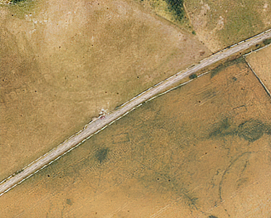
This aerial photograph was taken recently to accompany the latest Lidar survey of the Anglian palace site at Yeavering.
The road is the B6351 and you can make out the lay-by where Hope-Taylor’s Gefin monument stands.
Buildings and enclosures can be seen on both sides of the road but we are interested in that prominent circular henge, with its two entrances and suggestions of a trackway, on the right-hand side of the image.

Flodden
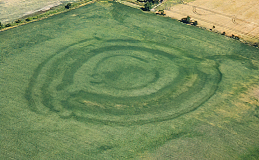
Here we can clearly see a more complex ground feature at Flodden.
