An Introduction to Low Hauxley
The coastal location of the excavations at Low Hauxley lies at the northern end of Northumberland’s magnificent Druridge Bay, just south of the village of Amble. The nearby Northumberland Wildlife Trust nature reserve is one of the finest in the area and was created when the area was restored following opencast coal mining in the 1970s.
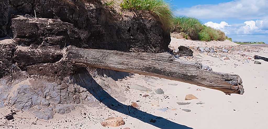
Go back in time around 7,000 years and the view at Low Hauxley would have been very different. The Late Mesolithic hunter-gatherer, standing where the beach and dune system is today, would have been in an ancient forest. The remains of this forest can be glimpsed today as a layer of peat, visible on the beach at low tide when conditions are right. Back then sea levels were lower and the forest would have stood around a kilometre from the shoreline. Closer inspection reveals considerable organic material, superbly preserved in alkaline calcareous conditions. Substantial tree trunks often emerge from the peat. The impressive specimen pictured on this page was lost in the storms of 2014, though others have now emerged.

Low Hauxley has, for a number of years, been recognised as a site of potential archaeological importance. The significance of the site was noted in the Rapid Coastal Zone Assessment Survey carried out by English Heritage. Another notable feature of the site is the rate of coastal erosion. Government figures suggest that around half a metre of the shallow, sandy cliff here is lost to the sea every year. However, as any local will tell you, the shore here is battered by some terrific winter storms which can easily remove more than their fair share of the coast. As well as continually revealing more of the hidden archaeology these storms, and the underlying coastal erosion, but the archaeology is under constant threat.
